Maps tell us so much more than the way to our destination
Post-modern homo-sapiens expect instant gratification. We buy automated pet-food dispensers and ready-peeled potatoes. It is hardly surprising that satellite navigation (sat-nav) systems are so popular. There are more than 14 million users in the UK: half of all drivers. But far from empowering, this so-called advance is starting to disconnect and de-skill people. We urgently need to regain our sense of place, and claim back the talents which our society has lost.
In HG Wells' The Time Machine, a Victorian scientist travels to the distant future to find that the remnants of a once-great culture are a beautiful but feeble species he calls the Eloi. Afraid of the dark, and unable to fend for themselves, the Eloi are preyed upon by the sinister Morlocks - their evolutionary cousins. Just like the Eloi, modern consumers are increasingly helpless: unable to slice carrots, and with no sense of direction. Some poor lost souls even have their sat-navs running whilst driving to work each day.
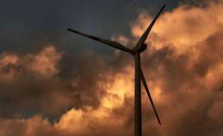
As if driving a car weren't polluting and dangerous enough, a growing body of evidence suggests that these electronic toys create a significant distraction for drivers. A survey in 2008 revealed that as many as 300,000 vehicle collisions in the UK, and five times as many near-misses, had been linked to sat-nav use, making them the successor to mobile phones for auto-imbeciles out to kill someone. This may have already happened, though evidence proves difficult to find following a fatal crash. In Japan, following a spate of accidents, sat-nav controls have been standardised, with touch-screen functions automatically blocked when a vehicle is moving.
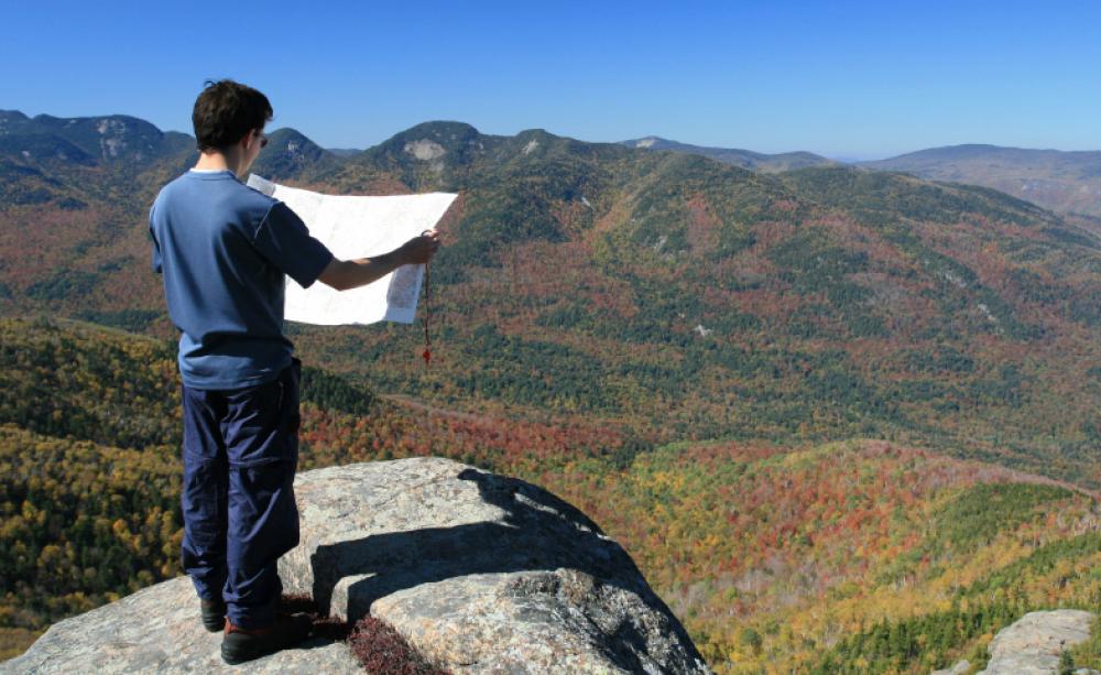
Of course, as crude oil production is approaching its peak, the car will one day be just a relic from our past. For now, however, half the population is doomed. Scrambling through a thick fog on the Langdale Pikes some years ago, I met a pair of fellow hill-walkers waving a handheld GPS. Over the noise of a gathering storm, they glumly asked whether I knew how to work the thing. They had no map. To prevent a potentially fatal incident, we teamed up and used my map to get off the hill.
The same thing is happening on the roads, with weekly reports of lorries getting stuck in cul-de-sacs and narrow lanes, and motorists blindly blundering into farmyards and over cliff-edges - with legal action looming for some. Trains have hit cars that have been driven onto railway lines. A delivery driver was charged last year after causing a crash on the Newcastle-Carlisle line.
The road less travelled
Sadly, with the growth of online mapping, sales of real maps and atlases have declined sharply over the last five years. Mary Spence, President of the Royal Cartographic Society, recently bemoaned the lack of interesting cultural detail in the white spaces between roads on electronic maps, and warned that we are losing our ‘sense of place' as a result. Maps tell us so much more than the way to our destination. Navigating and connecting with our surroundings are vital skills that we must not lose.
Maps tell us so much more than the way to our destination
History is written in the landscape. The origins of Britain lie along Roman roads, in ancient settlements, and in land reclaimed from the sea. Disputed borders reveal themselves in place names, archaeological sites and battlefields. And we have a rich tradition of villages with curious names like Myddle, Ryton XI Towns, London Apprentice and Chapel-en-le-Frith. Long forgotten craftspeople, family names, agricultural practices and folklore are all waiting to be found in the pages of a good atlas.
Contour lines may hide a slag heap, an iron-age settlement, or a local legend. Broad river valleys were carved by ancient glaciers; limestone pavements and valleys were formed beneath tropical lagoons millions of years ago. Patches of woodland - remnants of the time when all of Britain was covered by trees - are dotted around the countryside. Even if you can't be there today, this treasure is revealed through maps.
Maps give identity to our countryside, towns and communities, and help define our place in the world. We should all know where our local landmarks, towns, forests, streams, canals and hills are. How accurately on a blank map could the average person pinpoint the Cotswolds, Ben Nevis, the Forest of Dean or Stonehenge, the meandering River Severn, or where the Pennines start and end?
This matters on a global scale too. My parents' generation mourns the loss of old-style school geography lessons about far-off countries and cities. In these troubled times it is more vital than ever that kids discover our global neighbours.
As satellites beam images from distant war zones into our homes, and globalisation spreads its neoliberal tentacles, we cannot allow ourselves to be as ignorant of world geography as George Bush was before he embarked upon his ‘war on terror'. Everyone with a social conscience should be able to point to Israel, Afghanistan, Iraq, Chechnya, Cuba, Zimbabwe, Venezuela, Western Sahara and Tibet (to name but a few) on a map. If we allow ourselves to remain disconnected from the locations of conflict and disaster, we become disconnected from the events themselves.
So get a jigsaw with a map of the world on it, and do the New Internationalist crossword with The World Guide or an atlas at your side. Challenge yourself to list all of the countries in Africa, all fifty US States, or the capitals of every European country. Too easy? Then race your friends.
The great re-skilling
Map reading is a skill that is both fun and satisfying for its own sake. True, some people are better at it than others, but educational research reveals that our sense of direction is mainly due to nurture, not nature. I got myself trained some years ago and now teach kids how to read maps and enjoy the natural world using outdoor games and activities. This experience tells me that children love using maps to explore. They also like to be in control, so take them for a walk in the countryside and let them do the map reading. Give them a skill for life.
The Youth Hostel Association (YHA) run outdoor activity weekends with map reading tuition for individuals and families, catering for complete beginners as well as adrenaline-junkies. Or why not try your hand at orienteering? Taking the kids for a run around a forest with a map is much healthier than joining a gym. The British Orienteering Federation can provide you with a surprisingly long list of fixtures right on your doorstep. We did one last weekend with our five-year old and she loved it so much we've since drawn a map of the living room so we can play it at home.
If you want something less exhausting, try finding your nearest nature trail, or contact local history groups for details of walks in your area, both urban and rural. The Ramblers Association is bound to have a group near you.
There may be a compelling argument for getting a sat-nav system if family outings leave you on the verge of divorce. And satellite technology is clearly a life-saver for seafarers, polar explorers and mountaineers. But as technology provides mere mortals such as ourselves with ever more solutions to problems we didn't know we had, we seriously need to ask whether or not we are wise to grab them. Find that potato peeler, put the sat-nav on EBay, and dust off your old geography books. Bring the places you visit every day to life.
Trevor Critchley is a freelance writer, teacher and a member of the Arnold-Gedling Transition Town steering group
Tips for exploring
The countryside is available to explore at any time of year, whatever the weather, and requires little in the way of training or equipment. Unless you are in the Cairngorms, or on the side of the A1, you are unlikely to be in any real danger if you get lost - in fact, it can be a great learning experience to do so. Here's what you need to remember:
1. Get the right sort of map. Ordnance survey (www.ordnancesurvey.co.uk) are tremendous, and their website has a lot of good advice for novices. Use their 1:50,000 scale for a country ramble, but go for 1:25,000 for a walk in the hills, since everything - paths, fences, streams - is shown. At this scale, each 4 cm grid square on the map is 1 km on the ground.
For straightforward navigation and less complexity, you will probably find Harvey's maps (www.harveymaps.co.uk) more user friendly. They are tailored to the individual needs of walkers, cyclists and horse-riders. Check the scale before you start though.
2. Hold the map the right way round. Use features around you to orientate the map to figure out your starting position. That way, everything will line up on the map according to its position on the ground. And if you keep adjusting the map to make sure it is orientated correctly, then you can...
3. Tick off features as you pass them on your journey. Even better, work out what tick-features you are going to pass before you start. So if you know that in half a kilometre you will cross a stream and then meet a bend in the track, you'll be confident when you get there. And you can give everyone else a running commentary. This is also why knowing the scale (see above) is essential.
Exploring with children
'Learning to read maps provides children with a real sense of adventure,' says Hilary Palmer, Development Officer for the British Orienteering team. I grew up not far from the Lake District, and some of my earliest memories are of being dragged up various foggy hillsides in a sweaty orange cagoule. I sense this is not really the sort of approach Hilary is referring to.
Martin Chester, Chief Instructor at the National Mountaineering Centre in Wales suggests that the key to encouraging kids to love the outdoors is simple, 'make it achievable and stop before they've had enough.' Whilst adults often have a pre-set agenda (‘we're going to reach the top of that hill'), children are more open and inquisitive. 'On a day spent in the hills, kids will discover a million and one things to be amazed by.' he adds, 'Whilst adults often get bogged down in the nuts and bolts of the activity itself.'
Along the way they'll want to know about things that you may not even notice. A family day in the countryside should foster this, as long as it is planned with the flexibility to be altered on route - then you're not route-marching them back to civilisation before they have had time to enjoy themselves. Your kids may just enable you to see things you would otherwise have missed.
Useful websites
www.forestry.gov.uk A good starting point. Beautiful way marked woodland trails all over the UK.
www.ramblers.org.uk Local walking groups with knowledgeable guides.
www.britishorienteering.org.uk Family events with easy to read maps.
www.pyb.co.uk First class navigation courses (with added awe and adrenaline) at the National Mountaineering Centre, Snowdonia National Park.
www.yha.org Low cost family-oriented courses
www.adventureforall.org.uk and www.equaladventure.co.uk Catering for outdoor enthusiasts with disabilities.
www.newint.org Get the news about international development that you don't read in the papers, buy the World Guide and an atlas that shows countries in their real proportions.